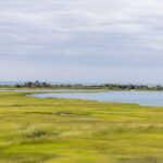
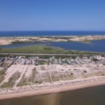
Waterfront and near-water homes are part of what makes Cape Cod real estate so appealing. But proximity to the ocean, bays, marshes and tidal waterways can also introduce risks and costs that buyers need to understand before making an offer.
A property’s FEMA flood designation can affect mortgage requirements, insurance expenses, renovation plans and how the property may need to be built or improved in the future. On Cape Cod, buyers should also consider something a standard FEMA map does not fully answer: how coastal flooding, shoreline change and sea level rise could affect the property over a longer ownership period.
Understanding Cape Cod flood zones therefore requires looking beyond a simple “in a flood zone” or “not in a flood zone” answer.
What Does It Mean When a Cape Cod Home Is in a Flood Zone?
FEMA creates Flood Insurance Rate Maps, commonly called FIRMs, that divide properties into different flood-risk zones.
The FEMA Flood Map Service Center is the federal government’s official source for these maps and should be the starting point when checking a property. FEMA notes that effective flood information can change through map updates and revisions, which is another reason to search the current map rather than rely on an old listing description or screenshot.
The zones buyers are most likely to hear about include A or AE zones, V or VE zones, and Zone X.
A and AE zones are within FEMA’s Special Flood Hazard Area and are subject to the 1%-annual-chance flood—sometimes called the “100-year flood.” The term does not mean flooding happens only once every 100 years. It means there is a 1% chance of that level of flooding being reached or exceeded in any individual year.
V and VE zones are also Special Flood Hazard Areas, but they are coastal high-hazard areas where storm waves and fast-moving water create additional risk. FEMA describes Zone VE as an area where waves can cause extensive structural damage during the 1%-annual-chance flood.
Zone X generally represents lower-risk areas outside the Special Flood Hazard Area. Shaded Zone X can represent moderate flood hazard, including areas associated with the 0.2%-annual-chance flood, while unshaded Zone X represents areas of minimal mapped flood hazard. But FEMA emphasizes that there is no true “no-risk” flood zone.
Do I Need Flood Insurance on Cape Cod?
Not every Cape Cod homeowner is legally required to carry flood insurance.
However, federal rules generally require flood insurance when a building securing a loan from a federally regulated or insured lender is located in a Special Flood Hazard Area. On FEMA maps, those high-risk areas generally include zones beginning with A or V.
A lender can also impose its own insurance requirements, so buyers should confirm requirements directly with their mortgage company rather than assuming that a particular map designation guarantees that insurance will—or will not—be required.
There is another important distinction: standard homeowners insurance usually does not cover flooding.
Flood coverage normally requires a separate flood insurance policy. Massachusetts residents may obtain coverage through the National Flood Insurance Program or through insurers offering private flood insurance. The Massachusetts Division of Insurance provides additional flood assistance and insurance information for homeowners and buyers.
Even when a lender does not require flood insurance, a buyer may still decide that coverage makes sense based on the property’s actual exposure.
How Much Does Cape Cod Flood Insurance Cost?
There is no reliable Cape-wide number.
Two properties in the same town—or even on the same street—can have different flood insurance premiums.
FEMA now prices National Flood Insurance Program policies under Risk Rating 2.0, which evaluates more property-specific characteristics than the older rating methodology. FEMA says factors can include distance from a water source and characteristics of the individual property, while replacement cost, the amount of coverage and deductible choices can also affect the premium.
That makes obtaining an actual insurance quote for the specific property far more useful than asking what flood insurance “normally costs on Cape Cod.”
If you are considering a home near the water, request a quote early in the buying process. For a property you intend to own for many years, insurance should be treated as part of the home’s ongoing ownership cost rather than an afterthought at closing.
Don’t Rely Only on the FEMA Map
This is especially important on Cape Cod.
Barnstable County currently notes that the most recent FEMA flood maps that became effective for all Cape Cod towns date to July 16, 2014. FEMA can make subsequent revisions and property-specific changes, so buyers should always check the live FEMA Map Service Center for current effective information.
More importantly, a FEMA Flood Insurance Rate Map is primarily a regulatory and insurance tool. It should not be treated as a complete prediction of what a coastal property may experience decades from now.
The Cape Cod Commission provides a Cape Cod Sea Level Rise Viewer that allows users to examine FEMA flood information alongside sea-level-rise scenarios and hurricane storm-surge data. The tool also illustrates potential effects on roads and critical infrastructure.
Massachusetts provides another useful resource through its Sea Level Rise and Coastal Flooding Viewer. State coastal-flood modeling can identify areas that may become vulnerable in the future even when they are outside today’s FEMA regulatory floodplain.
For someone purchasing a primary home, retirement property or second home they hope to keep for decades, looking at both current regulatory risk and projected future risk provides a much more useful picture.
Flood Risk and Erosion Risk Are Not the Same Thing
A property can also face coastal concerns that aren’t fully represented by its FEMA flood designation.
Cape Cod’s shoreline is naturally dynamic. Waves, currents, storms and the movement of sand continually reshape beaches, dunes, barrier systems and coastal banks. Massachusetts’ Office of Coastal Zone Management specifically identifies coastal properties as being exposed to risks from storm surge, flooding, relative sea level rise and erosion.
The state’s Massachusetts Shoreline Change Project provides historic shoreline positions and erosion-rate information that buyers can use when investigating coastal property. Cape Cod also has regional shoreline-change data showing patterns of erosion and accretion along major sections of the coastline.
This matters because a home sitting outside a high-risk FEMA flood zone does not automatically mean that a bluff, dune, beach or shoreline in front of it is stable.
For an oceanfront or highly exposed property, buyers may want to review erosion data and consult appropriate coastal professionals in addition to checking the flood map.
Flood Zones Can Affect Renovation and Rebuilding Plans
A buyer planning major renovations should investigate local floodplain regulations before purchasing the property, particularly if the home is older and located in a Special Flood Hazard Area.
Federal floodplain rules include requirements for buildings that are substantially improved or substantially damaged. FEMA generally defines substantial improvement as work whose cost equals or exceeds 50% of the structure’s market value, although communities can adopt more restrictive standards and rules regarding how improvements are accumulated.
For a Cape Cod property, compliance could potentially affect elevation, foundations, utilities, flood openings and how the lower portions of a building can be used. Massachusetts also requires flood-resistant construction within applicable mapped floodplains.
This can become particularly important if a buyer is looking at an inexpensive older waterfront cottage with plans for a substantial renovation.
Before assuming that the house can simply be enlarged or rebuilt in its existing configuration, speak with the town’s building department and, when appropriate, the conservation department.
Local Rules Matter on Cape Cod
FEMA establishes national minimum floodplain-management requirements, but Cape Cod towns can have additional zoning, wetlands and coastal-resilience regulations.
The Cape Cod Commission has developed coastal floodplain resiliency tools that municipalities can use to address present and future coastal hazards. The Commission’s model regulations are designed to help towns account for flooding, erosion and sea-level rise beyond basic federal minimums.
As a result, two homes with the same FEMA designation but located in different Cape towns may not necessarily face identical permitting considerations.
A buyer contemplating an addition, new pool, accessory structure, major renovation, elevation project, seawall work or other coastal construction should investigate the rules for that specific parcel and municipality.
What About Flood Insurance Discounts?
Some Cape Cod communities participate in FEMA’s Community Rating System, or CRS.
Under this voluntary program, communities receive credit for floodplain-management and risk-reduction activities that go beyond minimum NFIP requirements. Residents with eligible NFIP policies can then receive insurance discounts based on the community’s CRS rating.
Barnstable County currently identifies multiple Cape towns as CRS participants, with discounts varying by municipality, while other towns have been working toward participation.
Because participation and ratings can change, buyers should ask their insurance agent to determine whether a particular property currently qualifies for a CRS discount rather than relying on an older published percentage.
Buying a House in a Cape Cod Flood Zone: What Should You Check?
Being in a flood zone does not automatically make a property a bad purchase. It does mean that you should understand the property more thoroughly before deciding what it is worth to you.
Before buying, investigate:
- Search the exact address in the FEMA Flood Map Service Center and confirm the current flood zone and Base Flood Elevation where applicable.
- Get a property-specific flood insurance quote before closing rather than estimating the expense from another property.
- Ask whether the seller currently carries flood insurance and whether an Elevation Certificate or other flood documentation exists.
- Check Cape Cod and Massachusetts future-flooding tools in addition to the current FEMA map.
- Investigate historic shoreline change and erosion if the property is oceanfront, waterfront or near an exposed coastal bank.
- Ask about prior flooding or storm damage and review inspection findings carefully.
- Look at access to the property. A house itself may be elevated while the road providing access is vulnerable to flooding.
- Contact the town before planning major renovations to understand applicable floodplain, building, zoning and conservation rules.
- Consider the full long-term ownership cost, including insurance, mitigation, maintenance and possible future improvements—not just the purchase price.
The goal is not necessarily to eliminate every property with coastal exposure. It is to make sure the price, insurance cost, intended use and risk all make sense together.
Is Buying a Home in a Cape Cod Flood Zone a Bad Idea?
Not necessarily.
Many highly desirable Cape Cod properties are near beaches, harbors, marshes and other coastal areas where some degree of flood exposure is part of the location.
The important distinction is between knowing about the risk and pricing it into your decision versus discovering it after you own the house.
A properly elevated home with manageable insurance costs may present a very different situation from an older low-lying structure in a high-wave-risk area that a buyer intends to substantially renovate.
The flood-zone designation is therefore the beginning of the investigation, not the conclusion.
Frequently Asked Questions About Cape Cod Flood Zones
Do I need flood insurance on Cape Cod?
It depends on the property and financing. Buildings located in FEMA Special Flood Hazard Areas are generally subject to mandatory flood insurance requirements when the mortgage falls under applicable federal lending rules. A lender may also have additional requirements. Buyers outside those zones can still purchase flood insurance because lower mapped risk does not mean zero flood risk.
Does homeowners insurance cover flooding?
Usually not. FEMA and Massachusetts insurance authorities advise that standard homeowners policies generally do not cover flood damage. Flood insurance normally requires separate coverage through the NFIP or a private flood insurer.
What is the worst flood zone on Cape Cod?
Coastal V and VE zones generally represent particularly significant hazards because they combine flooding with damaging storm-wave action. That does not mean every property within a V zone has identical risk; elevation, construction and site conditions still matter.
Is Zone X safe from flooding?
Zone X represents lower mapped flood risk than a Special Flood Hazard Area, but FEMA specifically cautions that there is no “no-risk” flood zone. Buyers should consider property-specific conditions and future coastal-flood projections rather than interpreting Zone X as a guarantee that flooding cannot occur.
How do I find the flood zone for a Cape Cod property?
Search the property address through the FEMA Flood Map Service Center. For longer-term planning, also review the Cape Cod Sea Level Rise Viewer and Massachusetts coastal-flooding tools.
Buying a Cape Cod Home? Understand the Property Before You Make an Offer.
Flood zones, insurance, erosion and coastal regulations can have a meaningful effect on both the cost of ownership and what you can do with a property in the future.
Coastal Point Properties helps buyers look beyond the listing and evaluate the local considerations that come with purchasing a home, vacation property or second home on Cape Cod.
Talk to Coastal Point Properties about buying a home on Cape Cod and get local guidance as you compare properties and prepare to make an offer.
Flood maps, insurance requirements, premiums and municipal regulations can change. This article is for general educational purposes and reflects official information available in August 2026. Buyers should verify property-specific information with FEMA, their lender and insurance professional, the applicable Cape Cod town, and qualified legal or engineering professionals where appropriate.